Subsurface Intelligence with Muon Tomography
By transforming muon data into reliable 3D density maps, we help mining companies identify, characterize, and monitor mineral deposits with confidence. This reduces risk and cost of traditional methods, while saving time, optimizing return, and minimizing environmental impact across the mining value chain.
The biggest mining companies in the world have told us it’s a game-changer.
The Earth, transparent.
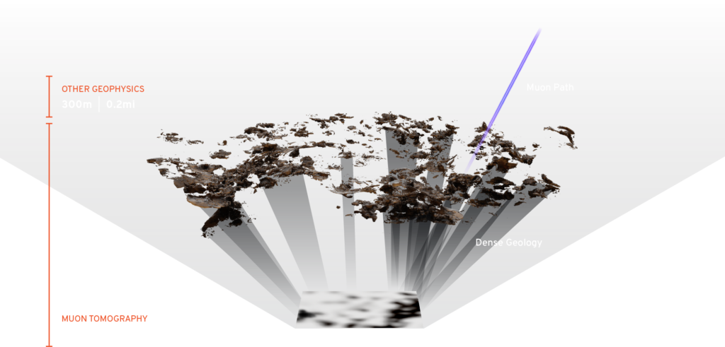
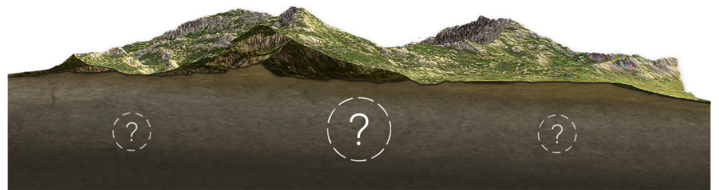
In subsurface environments where the scale, grade, and location of mineral deposits and anomalies are generally uncertain, Ideon provides 95% certainty on measurement of density — revealing the unseen.
Muon tomography is the only straight-line subsurface imaging technology available today, delivering the highest available resolution along with precise anomaly location information.
Subsurface Intelligence Platform™
The Ideon subsurface intelligence solution comprises proprietary hardware (that delivers a new-to-the-world data source), software, integrated imaging systems, and advanced data analysis and interpretation. Ideon also offers patented multi-sensor fusion capabilities that enable seamless data collection and integration from our proprietary sensors and third-party data. Our geostatistical modelling transforms the geological model into a high-resolution block model for operations.
Cosmic-Ray Muons
Muons penetrate Earth’s surface, and lose energy as they encounter material of different densities.
Detectors
Proprietary detectors in the survey area measure muon intensity within at least a 120° field of view.
Satellite to Cloud
The captured muon data is transmitted to the surface, then via satellite to Ideon.
2D Radiographs
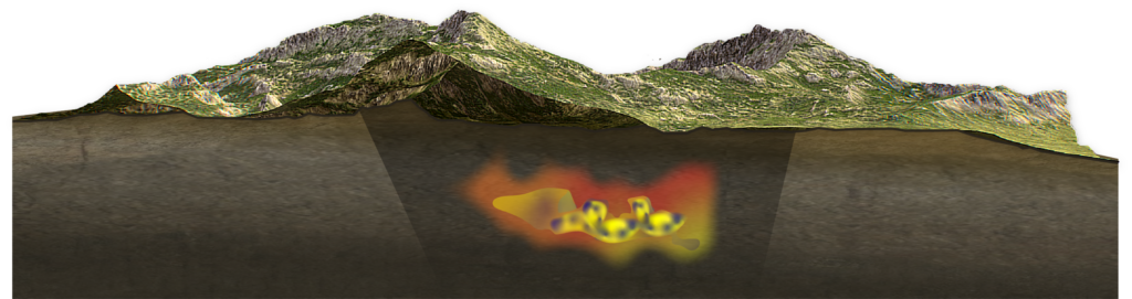
The data is transformed into x-ray-like images of density anomalies in the survey area.
3D Density Model
Inversion technologies create subsurface 3D density models.
A solution with benefits across the mining value chain
Our holistic and integrated approach is a catalyst for system-level transformation in mining, just when the world’s largest mining companies are reimagining their operations to deliver a step-change in production while meeting ambitious environmental goals. We make it easy, bundling our custom hardware, deployment expertise, data analysis, and multi-physics inversions as a service to deliver a complete end product to our customers.
We see a range of key applications across the mining value chain:
Mineral Exploration
Mining companies make major decisions with very limited knowledge about the ore bodies in the area. A lack of geological certainty creates risk of failure to meet targets. The only option at depth is drilling, which brings more cost, time, and permitting challenges.
Better subsurface intelligence provides greater geological certainty, which allows for better targeting, reducing time to conversion and market yield.
Ore Characterization
Today, drill core samples are sent to a lab for manual characterization, making exploration costly and time-consuming and impacting productivity and viability of the operation. Samples are sparse and expensive.
Better subsurface intelligence provides timely, accurate information about the 3D mapping of geological structure, reducing barriers to cost-effective resource discovery, management, and processing.
Geotechnical Mapping
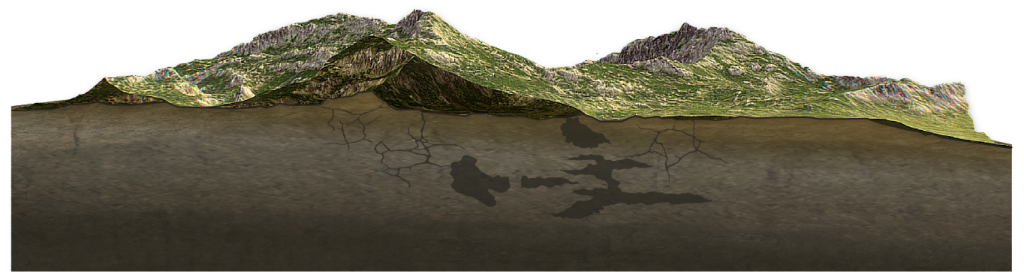
Mining companies make significant investments in tools of limited accuracy, resulting in uncertainty of geological behaviour or dangerous features (including collapsed tunnels, stopes, and other environmental hazards) beneath the surface.
Better subsurface intelligence provides geotechnical insights into subsurface workings, subsidence zones, and voids, helping to prevent injury, equipment damage/loss, and costly surprises.
What’s next? Beyond muon tomography…
While it’s true that we love muon tomography, we also believe in the power of multi-physics fusion. We’re currently developing several complementary imaging sensors as well as advancing our joint inversion capabilities to seamlessly integrate gravity, magnetometry, and seismic data sets.