August 27, 2024
VALE BASE METALS
Muon Tomography for Mapping Voids & Remnant Mineralization
High-resolution imaging of voids and rubble zones, mined-out stopes, underground workings and cave, and remnant mineralization.

Creighton Mine
PROJECT
Sudbury, Canada
LOCATION
Borehole
IDEON DETECTOR TYPE
Subsurface Voids & Remnant Mineralization
TARGET TYPE
Highlights
The unconstrained analysis, later validated with drill data and geological modelling provided by Vale Base Metals, delivered high-resolution geological and geotechnical insights throughout the survey area:
BACKGROUND
Located about 15 km west of Sudbury, Ontario, Creighton Mine is an underground nickel, copper, and platinum-group elements (PGE) mine. It is currently the deepest nickel mine in Canada, and one of the ten deepest mines in the world (at 2.4 km). Open pit mining began at Creighton in 1901, followed by underground mining in 1906. At one point, two-thirds of the world’s supply of nickel was mined there. The deposits at Creighton Mine were the first mineralized deposits discovered in the Sudbury Igneous Complex (SIC) mining camp, dating back to 1856. It hosts contact- and footwall-style mineralization. Current expansion plans could extend the life of Creighton Mine from 2027 to 2038.
IDEON SOLUTION
Ideon provided Vale Base Metals with a full-service imaging and intelligence program, including customized deployment design and modelling to ensure optimal outcomes, turnkey equipment bundling and installation logistics, continuous imaging with regular updates to show progressive resolution improvement, remote monitoring and diagnostics, geoscientific analysis and interpretation, and onsite results immersion.
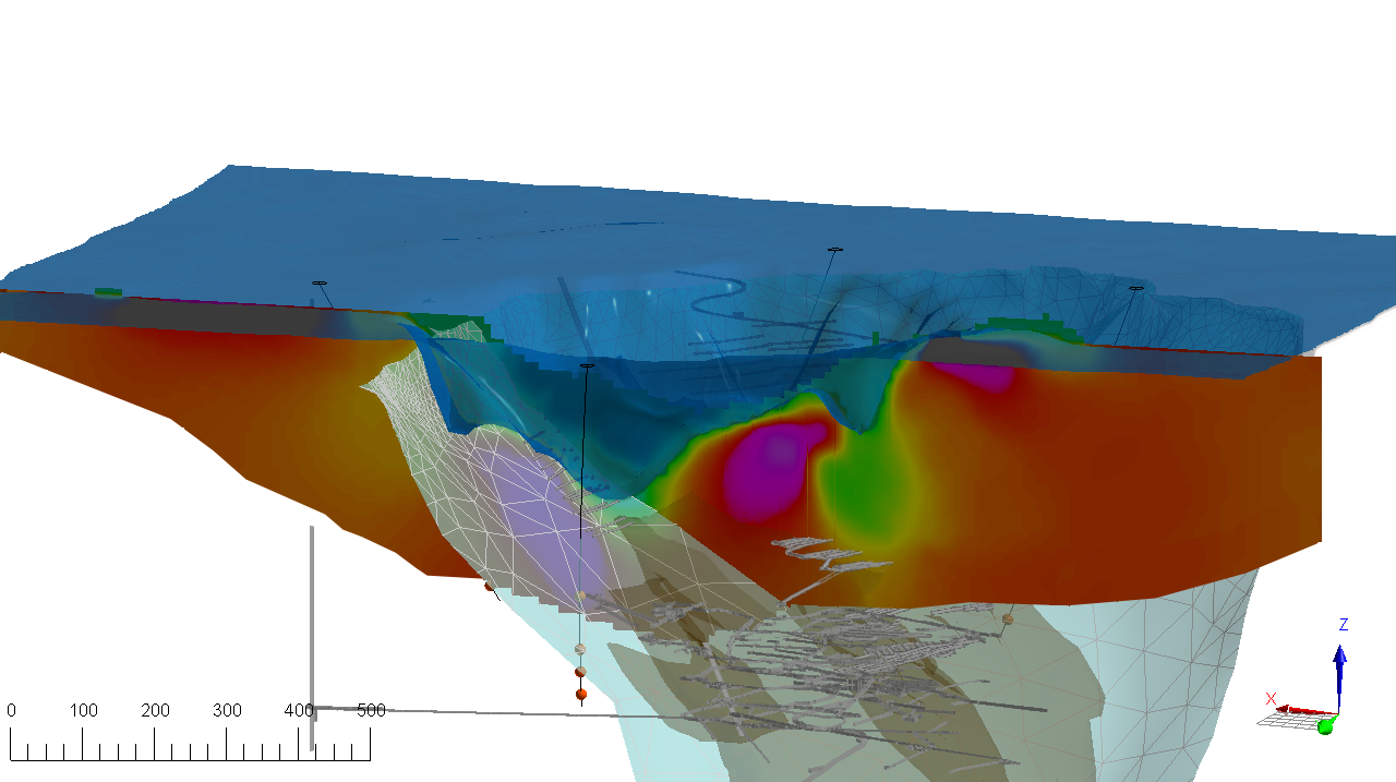
The objective of the study was to demonstrate muon tomography for void mapping in an area where the geological model was well understood, helping validate models of the void area and lower the geotechnical risks involved in operations in an older mine site. Ideally, the survey would provide additional value to Vale Base Metals by successfully identifying areas of remnant mineralization that may have been deprioritized in earlier mining operations. The primary imaging target was the contact between competent rock and the rubble, at the bottom of the historic pit.
Ideon deployed 16 borehole detectors in four sensor arrays, down four drillholes positioned around the historic open pit on the Creighton site. The detectors were situated from approximately 200 m to 645 m deep and gathered data over a period of 6 months. Data intake and analysis in the Ideon cloud platform were conducted remotely via high-speed cellular connection to verify quality and system calibration, unlock near-real-time subsurface density imaging with continuously improving resolution.

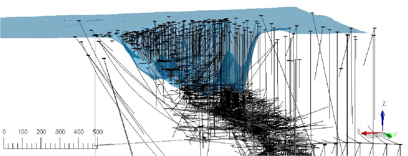
Creighton Mine, showing intensity of drilling activity (500+ drillholes completed over decades of active exploration and mine operations.
Ideon then delivered a robust 3D density model of the target area using muon data without any constraining geological information. This was a blind, unconstrained data analysis. After the delivery of the 3D density model, results were mapped to the Vale geological model to validate outcomes.
Discover the outcomes at Creighton
Download the full case study for detailed content and analysis at the Creighton project.


